Stöbern
genialokal zum Startbildschirm hinzufügen
Installieren Sie die genialokal App auf Ihrem Startbildschirm für einen schnellen Zugriff und eine komfortable Nutzung.
Installieren Sie die genialokal App auf Ihrem Startbildschirm für einen schnellen Zugriff und eine komfortable Nutzung.
Tippen Sie einfach auf Teilen:
 Und dann auf "Zum Home-Bildschirm [+]".

Bei genialokal.de kaufen Sie online bei Ihrer lokalen, inhabergeführten Buchhandlung!
Ihr gewünschter Artikel ist in 0 Buchhandlungen vorrätig - wählen Sie hier eine Buchhandlung in Ihrer Nähe aus:
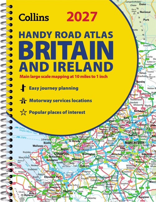
Explore Britain with easy-to-read mapping from Collins.
This easy-to-use, handy A5 road atlas with spiral binding features extremely clear route planning maps of Britain and Ireland, and fits neatly into your glove box or bag.
The maps of Britain are at 10 miles to 1 inch (1:625,000) and the whole of Ireland is covered at 15.8 miles to 1 inch (1:1,000,000). There is also a selection of more detailed urban area maps at 4.5 miles to 1 inch (1:285,000) to aid route planning in these busy areas.
Main features:- Road maps that focus on the main roads, motorways and settlements- More detailed maps of London, Manchester, Merseyside and West Midlands- Updated Park & Ride locations, new rail stations and extensions to tram lines in Blackpool and Edinburgh- Handy distance calculator chart highlighting distances between the major towns- Over 30 categories of places of interest including castles, theme parks, sports venues and surfing beaches- Now includes dual Welsh / English names for Welsh locations, for example, Caerdydd / Cardiff
Explore the world through accurate and up-to-date mapping.