Stöbern
genialokal zum Startbildschirm hinzufügen
Installieren Sie die genialokal App auf Ihrem Startbildschirm für einen schnellen Zugriff und eine komfortable Nutzung.
Installieren Sie die genialokal App auf Ihrem Startbildschirm für einen schnellen Zugriff und eine komfortable Nutzung.
Tippen Sie einfach auf Teilen:
 Und dann auf "Zum Home-Bildschirm [+]".
Bei genialokal.de kaufen Sie online bei Ihrer lokalen, inhabergeführten Buchhandlung!
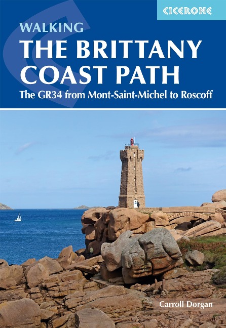
A guidebook to walking the northern section of the GR34 Brittany Coast Path, following 624km (388 mile) of dramatic coastline from Mont-Saint-Michel to Roscoff. Known as the Sentier des Douaniers or Customs Officers' Path, the trail traces one of France's most celebrated long-distance routes, revealing a constantly changing landscape of rugged cliffs, sweeping bays, sandy beaches and rocky headlands. Along the way, walkers pass historic ports, traditional fishing villages and lively seaside towns, experiencing the distinctive character, history and culture of Brittany. Suitable for any moderately fit walker, this section of the GR34 can be completed in around a month and requires no technical skills. The route is described from east to west in manageable daily stages, allowing walkers to experience the full variety of Brittany's coastline at a comfortable pace. For those with less time, the guide also highlights shorter itineraries that capture some of the most spectacular scenery and rewarding sections of the trail. - The Brittany Coast Path is described in 28 stages of between 13 and 33km, with clear step-by-step route descriptions, detailed mapping and route summary tables to help you plan daily distances and accommodation. - Includes 1:100,000 mapping for each stage, larger-scale maps for towns and key locations, like Saint-Malo, Saint-Laurent de la Mer, Morlaix, Carantec and Roscoff. - GPX files for the Brittany Coast Path available to download for easy navigation on digital devices. - Comprehensive practical information on accommodation, food and refreshments, public transport connections and local facilities, making it easy to organise and adapt your GR34 itinerary. - Includes four suggested 5-day highlight itineraries, ideal for walkers who want to experience the highlights of the Brittany Coast Path on a shorter trip. - Helpful planning advice covering preparation, travel to and from the route, accommodation listings, and tips for walking a long-distance coastal trail. Following in the footsteps of the customs officers who once patrolled this coast to prevent smuggling, the GR34 offers an unforgettable journey through one of France's most beautiful and culturally rich regions. With ever-changing sea views, abundant wildlife and countless opportunities to enjoy Breton hospitality and cuisine, this guide provides everything you need to explore this remarkable coastline with confidence.
Carroll Dorgan was born and educated in the United States and initially pursued a teaching career for a decade in international schools in Iran, Belgium, England and France. He then returned to California to qualify as a lawyer but soon moved back to Europe to practice international law in the Netherlands and France. In all of those places, he explored nearby hiking trails. Over the years, the GR5 became Carroll's favourite trail and he wrote a Cicerone guidebook for the northern part of the route. Then he discovered Brittany and with each hike on the magnificent Breton coast, he became keen to learn more and to share his love of the region with Cicerone's readers.
Map key Overview map Route summary table Introduction What it's like to hike on the north Brittany coast Geology Wildlife History Culture When to go Getting there and around Accommodation Clothing and equipment Waymarking Maps Money Staying in touch Health and safety Using this guide The Brittany Coast Path Stage 1 Mont-Saint-Michel to Saint-Broladre Stage 2 Saint-Broladre to Cancale Stage 3 Cancale to La Guimorais Stage 4 La Guimorais to Saint-Malo Stage 5 Saint-Malo to Lancieux Stage 6 Lancieux to Saint-Cast-le-Guildo Stage 7 Saint-Cast-le-Guildo to Petit Tr&##xe9;celin Stage 8 Petit Tr&##xe9;celin to Sables-d'Or-les-Pins Stage 9 Sables-d'Or-les-Pins to Pl&##xe9;neuf-Val-Andr&##xe9; Stage 10 Pl&##xe9;neuf-Val-Andr&##xe9; to Hillion Stage 11 Hillion to Saint-Laurent-de-la-Mer Stage 12 Saint-Laurent-de-la-Mer to Saint-Quay-Portrieux Stage 13 Saint-Quay-Portrieux to Br&##xe9;hec Stage 14 Br&##xe9;hec to Paimpol Stage 15 Paimpol to L&##xe9;zardrieux Stage 16 L&##xe9;zardrieux to Le Qu&##xe9;bo Stage 17 Le Qu&##xe9;bo to Tr&##xe9;guier Stage 18 Tr&##xe9;guier to Port Blanc Stage 19 Port Blanc to Perros-Guirec Stage 20 Perros-Guirec to Tr&##xe9;gastel (Coz Pors) Stage 21 Tr&##xe9;gastel (Coz Pors) to Île Grande Stage 22 Île Grande to Le Yaudet Stage 23 Le Yaudet to Locquirec Stage 24 Locquirec to Plougasnou Stage 25 Plougasnou to Saint-Samson Stage 26 Saint-Samson to Morlaix Stage 27 Morlaix to Carantec Stage 28 Carantec to Roscoff Appendix A Four 5-day itineraries on the GR34 Appendix B Facilities table Appendix C Accommodation Appendix D Transport Appendix E Useful contacts Appendix F Glossary