Und dann auf "Zum Home-Bildschirm [+]".

Stöbern
genialokal zum Startbildschirm hinzufügen
Installieren Sie die genialokal App auf Ihrem Startbildschirm für einen schnellen Zugriff und eine komfortable Nutzung.
Installieren Sie die genialokal App auf Ihrem Startbildschirm für einen schnellen Zugriff und eine komfortable Nutzung.

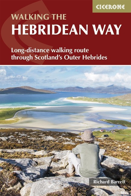
Discover an island adventure on the Hebridean Way, Scotland's only island-hopping long-distance trail. This waymarked route runs the length of the Outer Hebrides, covering 247km (155 miles) from Vatersay in the south to Stornoway in the north. Linking ten islands by a series of causeways and ferry crossings, the trail travels through some of the most distinctive landscapes in the UK, from white-sand beaches and flower-rich machair to remote moorland, rocky headlands and Atlantic-facing coastlines. This guidebook provides everything needed to plan a two-week walk along the Hebridean Way with confidence, whether you are undertaking the full route as a multi-day journey or exploring selected sections. Clear route descriptions are combined with practical planning advice and contextual information, helping you navigate the logistical challenges of island travel while making the most of time spent on the trail. - The route is presented in 10 stages of 1635km (1022 miles) between Vatersay and Stornoway, with an optional 48km (30-mile) extension to the northern-most point on the island, the Butt of Lewis, for a true end-to-end crossing of the archipelago - Each stage includes detailed route descriptions, supported by 1:50,000 Ordnance Survey mapping, allowing you to follow waymarked paths, minor roads and coastal tracks with ease - Practical guidance covers when to go, transport logistics, ferry connections, whilst a trek planner details all accommodation and facilities at key towns and villages, helping you plan a multi-island walking holiday - Background notes on history, archaeology, geology, wildlife and Gaelic place names bring the landscapes of the Outer Hebrides to life, adding depth and context to the walking experience - Downloadable GPX files are included for use on smartphones or GPS devices, offering a digital navigation option - With generally moderate terrain and no technical mountain walking, the Hebridean Way is accessible to most walkers with a reasonable level of fitness. Passing through Barra, Eriskay, South Uist, Benbecula, North Uist, Harris and Lewis, this trail offers a rare combination of island hopping, coastal walking and cultural immersion. The Hebridean Way showcases the Outer Hebrides at their most atmospheric, from expansive beaches and big skies to quiet settlements and ancient sites, making it one of the most distinctive long-distance walks in Scotland.
Richard Barrett spent his working life as a professional marketer, but still found time for climbing, winter mountaineering and sea kayaking. He first visited the Harris hills as a teenager and became a regular visitor. He lived in North Harris for a number of years, where he and his wife ran a guest house and, although now a city-dweller, he still makes frequent forays to the Hebrides, reconnecting with the wilderness and catching up with old friends.
Map key Route summary table Overview maps Trek planner Introduction How the Hebridean Way came into being Planning your trip Selecting a schedule When to walk Getting there First and last nights Accommodation Facilities Money matters Baggage transfer What to take Planning day by day Using this guide Maps Waymarking Weather forecasts Phones and Wi-Fi Emergencies All about the Outer Hebrides Geology Plants and flowers Wildlife The history of the Outer Hebrides Economy The Hebridean Way Stage 1 Vatersay to Ardmhor Stage 2 Eriskay to Howmore Stage 3 Howmore to Baile nan Cailleach Stage 4 Baile nan Cailleach to Lochmaddy Stage 5 Lochmaddy to Berneray Stage 6 Leverburgh to Horgabost Township Stage 7 Horgabost Township to Tarbert Stage 8 Tarbert to Aline Stage 9 Aline to Laxay Stage 10 Laxay to Stornoway Additional stages to the Butt of Lewis Stage 11 Stornoway to New Tolsta Stage 12 New Tolsta to the Butt of Lewis Appendix A Useful contacts Appendix B Accommodation Appendix C Common Gaelic and Norse name elements Appendix D Further reading