Und dann auf "Zum Home-Bildschirm [+]".
Stöbern
genialokal zum Startbildschirm hinzufügen
Installieren Sie die genialokal App auf Ihrem Startbildschirm für einen schnellen Zugriff und eine komfortable Nutzung.
Installieren Sie die genialokal App auf Ihrem Startbildschirm für einen schnellen Zugriff und eine komfortable Nutzung.
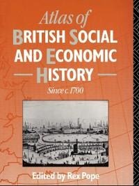
All students of history use maps. This atlas is designed specifically to enhance the understanding of British history since 1700, as well as emphasizing social as well as economic change. The contributors are all subject specialists who have taught in higher education institutions, and a large proportion of both maps and text is based on their own original research. The combination of maps and text is intended to illustrate not only historical developments, such as the spread of agriculture or the growth of an integrated transport system, but also regional contrasts at points in time. The end product offers support for those historians who question the usefulness of thinking in terms of national economic histories.
Rex Pope, Lancashire Polytechnic
Introduction 1 Agriculture 2 The textile and chemicals industries 3 Metal, vehicle, and engineering industries 4 Coal, gas, and electricity 5 Transport and trade 6 Demographic changes 1701-1981 7 Employment and unemployment 8 Urbanization and living conditions 9 Labour movements 10 Education: late nineteenth-century disparities in provision 11 Religion 12 Leisure